Monday, November 16, 2020

Edna Collings Bridge

 Located just outside the tiny little town of Clinton Falls, Indiana is the curious covered bridge called the Edna Collings Bridge.

GPS Coordinates: 39.72750, -86.97633 

We decided to make the hour and a half road trip up to see this bridge just before Halloween as my daughter was interested in the ghost story attached to it.  According to legend, it is haunted by a mother and her young daughter.  The story goes that a little girl named Edna Collings would play in the Little Walnut Creek that flowed under the bridge, swimming and having a good time.  Frequently, her parents, James and Sarah Collings, would drop her off at the bridge while they went into town to take care of their errands (though one story says they had gotten a job at a nearby shoe factory in Greencastle which is about ten miles away) and when they returned they would honk three times and she would come up from the creek, climbing into the car for the return trip home.  One day, however, Edna failed to return to the car.  She was found drowned nearby, her dog barking on the creek bank.

Little Walnut Creek travels under the Edna Collings Bridge; (c) Amber Reyes

There are variations to the story concerning her death.  I have found some tellings that say her body was never found and that she had vanished into nothingness leaving behind nothing but her hair ribbon, while others say that her father found her body laying on the edge of the creek.  Either way, the circumstances of her death are unknown.

Indiana Historical Society; c1940s

The legend continues that the parents divorced after Sarah accused James of the death of the little girl.  He lost his job and began to drink heavily and Sarah cried every night without fail.  She became so distraught over the death of her daughter, that she hanged herself, though this also has variations.  One tale says that the mother hanged herself from the bridge and another at the nearby churchyard.  The story also states that the father built the bridge in honor of his deceased daughter (this also has variations since in one story the bridge was built by James Collings in honor of the birth of his fourth daughter).

Interior of Edna Collings Bridge, (C) Amber Reyes

Many people travel to this bridge to encounter the ghosts of Edna and her mother.  Supposedly, to see the spirit of Edna, one must drive onto the bridge, turn off the vehicle and honk three times.  This is her signal to appear and she is said to attempt to get into the back of the car.  Some have reported seeing handprints on the bumpers and doors of their cars.  The mother, however, requires a little more of a hunt.  One is supposed to take a piece of rope from the sign of a nearby church and return to the bridge.  Once there, the shadowy figure of a woman is supposed to appear.

Elkhart Public Library; c1952

I do love ghost stories, especially ones that are attached to places I can drive to locally.  And as I did research on this story, not really to debunk it, but to find out more about it, I did come across some interesting information which actually does kind of debunk the story.  First and foremost, the bridge was not built by James Collings (or Collins) in 1922 in the memory of his daughter Edna.  It was, in fact, built by Charles Hendrix (or Hendricks).  The design is called a Burr arch-truss bridge and it spans 80 feet across the creek, 84 including the ramps up and down on either side.  It is 14 feet wide and 13 feet high.  An inspection in 2011 listed it as being in poor condition and in need of restoration.  It is eligible for the National Register of Historic Places, though it doesn't look like anyone has put in a formal application.  Another story claims that it was built by a man named George Collins/Collings, but this isn't repeated anywhere else other than one story, so I don't give it much credit.

The bridge was built to replace a previous concrete bridge that was washed away during high water.  When looking at the tiny little creek that runs underneath the bridge, it's hard to imagine that the water could have ever been high enough to wash out a bridge.

The bridge itself is in abysmal condition and I didn't dare drive across it.  The road ramps up sharply on both entrances of the bridge and gouges have been dug into the asphalt from various vehicles.  I know that this bridge gets regular use, but it creaked and groaned as we walked across it, so I wasn't taking any chances.  


There is some confusion as to the families last name.  I am not really sure where the confusion comes from, other than a misspelling somewhere along the way.  The bridge reflects this misspelling, in fact.  The side of the bridge that we approached from had a green sign noting that it was the Collins Bridge 1922 with the name Edna added on later.


The other side of the bridge shows a newer sign calling it the Edna Collings bridge with the same date of 1922.  

There was, at one time in the recent past, a small brown sign attached to the inside of the structure that talked about the history of the bridge and the story of Edna.  I didn't see it when we were there.  I don't know when or why it was removed.  

Another story I have found attached to this bridge is one that is much more controversial. In the mid 1800s, in the tiny town of Portland Falls, there lived a young doctor and his lover, who was younger than him.  The girl eventually got pregnant and in a panic the doctor attempted an abortion that led to her death.  In an attempt to hide the young woman's death, he tossed her body from the bridge into the creek.  This story, of course, would have been from when the previous bridge was here, though it would have to have been before the concrete bridge as well, so maybe a wooden structure of some sort.  It is said that the spirit is actually the young woman in this story.  

But, there is a truth the story.  And it doesn't involve the death of a young girl named Edna Collins.  There was a woman named Edna Collings and she was born on August 30, 1851.  At the time that the story takes place, Edna would have been 71 years old and could not have drown in the creek as a child.  She is buried in Mount Moriah Cemetery near Hollandsburg, Indiana with her older brother.  The bridge was indeed named after her, but there is a very good explanation as to why.  The Collins family owned the farm southwest of the bridge and the county commissioner's appeared to have taken the name of the closest family for the bridge.  The name, however, is spelled both Collins and Collings due to a misspelling somewhere in various documents.  It is likely that their last name was actually Collings since that it on both the headstone of Edna and her brother, as well as her parents John and Sarah (note, his name is John, not James, though James and John have been used interchangeably throughout time).

Wayne M. Weber Collection, c. 1950-70s
Even though Edna Collins didn't perish under this bridge, there is another story that seems to have a little more bearing on the tales.  In 1911, a young boy named Cecil Slavens, son of Charles and Sarah Slavens, wandered away from the farm where they lived, his dog in tow.  When the family couldn't locate the boy, two and a half years old at the time, they went searching for him.  Alerted by the dog, they found him face down in the water of a tributary of the Little Walnut Creek, cold with death.  A local doctor was summoned, who determined that the child must have drowned in the creek and he was laid to rest in the Long Branch Cemetery in Madison Township.  

Where is the link with Edna, you ask?  Young Cecil had an older sister.  Her name?  Edna Ruth Slavens.  Age? 8 years old.  It is likely then that the stories have been conflated over the years and poor Edna Collins has been turned into a small child who suffered a tragic fate while the real story of a child drowning nearby was almost lost.

If you do decide to travel to this bridge, be respectful of the structure and the neighbors.  Oh and do look for Edna.  Her name is bound to be somewhere.


~~~

Resources:

various ghost story websites all stating the same or similar stories

FunCityFinder

Ghost is the Word

The Putnam County Historian

Indiana History Digital Collection

Indiana State University Archive


Secrest Ferry Bridge

 Today's stop is at the Secrest Ferry Bridge in Gosport, Owen County, Indiana.  

GPS Coordinates: 39.33253, -86.67685

This bridge was constructed in 1903 by the Vincennes Bridge Company.  It was designed by the Lafayette Engineering Company and is the longest Pennsylvania truss bridge in Indiana.  It crosses a section of the West Fork of the White River just outside of the historic town of Gosport, Indiana.

It was closed in 1990 when the newer bridge was constructed a few hundred yards away.  In 2008, it was refurbished to be a footbridge for pedestrian use. 


The Lafayette Engineering Company (also listed as the Lafayette Bridge Company) was an important designer and builder of truss styled bridges in Indiana and Illinois with at least 17 attributed to them.  They began in 1891 with the idea that they could fabricate efficient and simple bridges with the newest manufacturing techniques.  They designed many bridges, but for this particular project they did not have the manufacturing capability and had to contract it out to the Vincennes Bridge Company, which was founded in 1898 by three school teachers and went on to build more than 1200 bridges by 1920 across several different states.

It is 320 feet in length, while the structure as a whole is 323 feet.  

In 1996, it was added to the National Register of Historic Places.

Side A of the sign reads: "Pennsylvania through truss iron bridge built 1903 by Lafayette Engineering Co. crosses West Fork of White River, spans 316 feet, and rests on concrete and stone abutments.  One of the longest single-span iron bridges in Indiana: longest highway bridge of its type.  Has unique iron framework, original lattice railing.  Replaced Secrest's Ferry."
Side B of the sign reads: "Commissioners from Owen and Monroe counties met in 1901 to plan for a bridge.  Owen paid two-thirds of cost.  Monroe one-third.  Served as vital link between Gosport and Spencer and Bloomington.  Closed to vehicles and bypassed by the modern bridge to the west 1990.  Listed National Register of Historic Places 1996"
Unfortunately, the sign has been vandalized repeatedly.


It has a few different names, Owen County Bridge #9, Monroe County Bridge #164 or the Gosport Bridge.


The bridge was an important link between Owen and Monroe counties as it was built to provide a safe crossing over the White River for the public highway, which not only passed through Gosport, Spencer and Bloomington, but also the nearby historic quarry town of Stinesville.  The bridge was a very important continuation of the transportation history of the area as it replaced a ferry crossing that was only passable at low water levels.

The history of the bridge started around September 4, 1894 with a "petition  stating that 'public convenience' required a bridge across the White River between Owen and Monroe counties".  The first time that this petition was brought forth, it didn't go well and was rescinded in March of 1895.  They tried again in 1901, this time stating that the bridge was suitable for "wagons and other vehicles".  The petition stated that this was a necessity as there was "no way to cross the river at said point or near thereto only by fording, which can only be done when the river is low and then such fording is attending with great danger".  This river ford was called Secrest Ferry and was run by the prominent landowner James Secrest, whose home still stands to this day.

There already existed a bridge on the east side of town.  This one was a wooden covered bridge that was actually closer to Gosport but wasn't on the main route and required travelers to go an extra nine or ten miles out of the way.  Unfortunately, this bridge was completely destroyed by arsonists in 1955 and was not rebuilt.

A short drive from Bloomington or Spencer, this bridge is definately worth a trip.  It is a lovely spot with a delightful view of the White River.  There is no specific parking and is next to private property.  There is a junked mini-van with a sign stating that the area is protected by security cameras, which is a good plan since it appears that vandals hang around regularly.

~~~

Resources:

Bridgehunter.com

National Register of Historic Places

Indiana Bridges Historic Context Study

archinform 

National Register of Historic Places Application 

Welcome!

 After some thought and recent travels, I have decided to expand the content of this blog to include more than just the towns that dot our landscape.  Instead, I have decided to expand the focus to add in the buildings, bridges and people as well.


There is so much to Indiana that many people don't know about and it's all getting lost in the muddle of time and current events.  Therefore, welcome to Our Historical Indiana.  


Keep an eye out for more posts about the things that we find as we travel around.  Also, make sure that you check the links as some will cross reference burial sites and cemeteries found on my sister blog, A Walk Through The Tombstones.

Monday, November 9, 2020

Scotland, Indiana

 Hello!   It's been a long time.  I had started several posts and not finished them since I have been doing regular research into the places that I have been, but today, I can bring you a post about the tiny little unincorporated town of Scotland, Indiana.

It is located in Taylor Township, Greene County, GPS Coordinates: 38.913164, -86.904092.  In 2010, the population of the town was 134 people (the Scotland Cemetery has over 1,000 burials).  It is listed about being .6 sq miles with an elevation of 610 feet.  

~~~~

We made our way west toward Greene County, Indiana, taking St. Rd. 45 S for about 20 miles, passing through the towns of Stanford and Cincinnati until we came to the intersection where it met up with St. Rd 58.  It's at this point that we encountered Crane Navel Base, a place that is very busy and highly secure.  Turning right onto St. Rd 58/45 W we continued on our adventure passing through Doans and finally to a left hand turn onto West Gate Rd which spills directly into the town of Scotland.

I was rather unimpressed with the town as we were under the assumption from photos that we had seen that there would be more to do and to look at.  In reality, it has very little going for it other than a music stage, a lawnmower repair shop, a post office, a tiny park, a cafe, a barbershop, a cemetery and the historical society.  It was Sunday, so nothing was open and we couldn't really get an idea of what life was like in this sleepy little town, so we just took pictures and headed for the cemetery.  There will be an entry for the Scotland Cemetery in my other blog, A Walk Through The Tombstones.


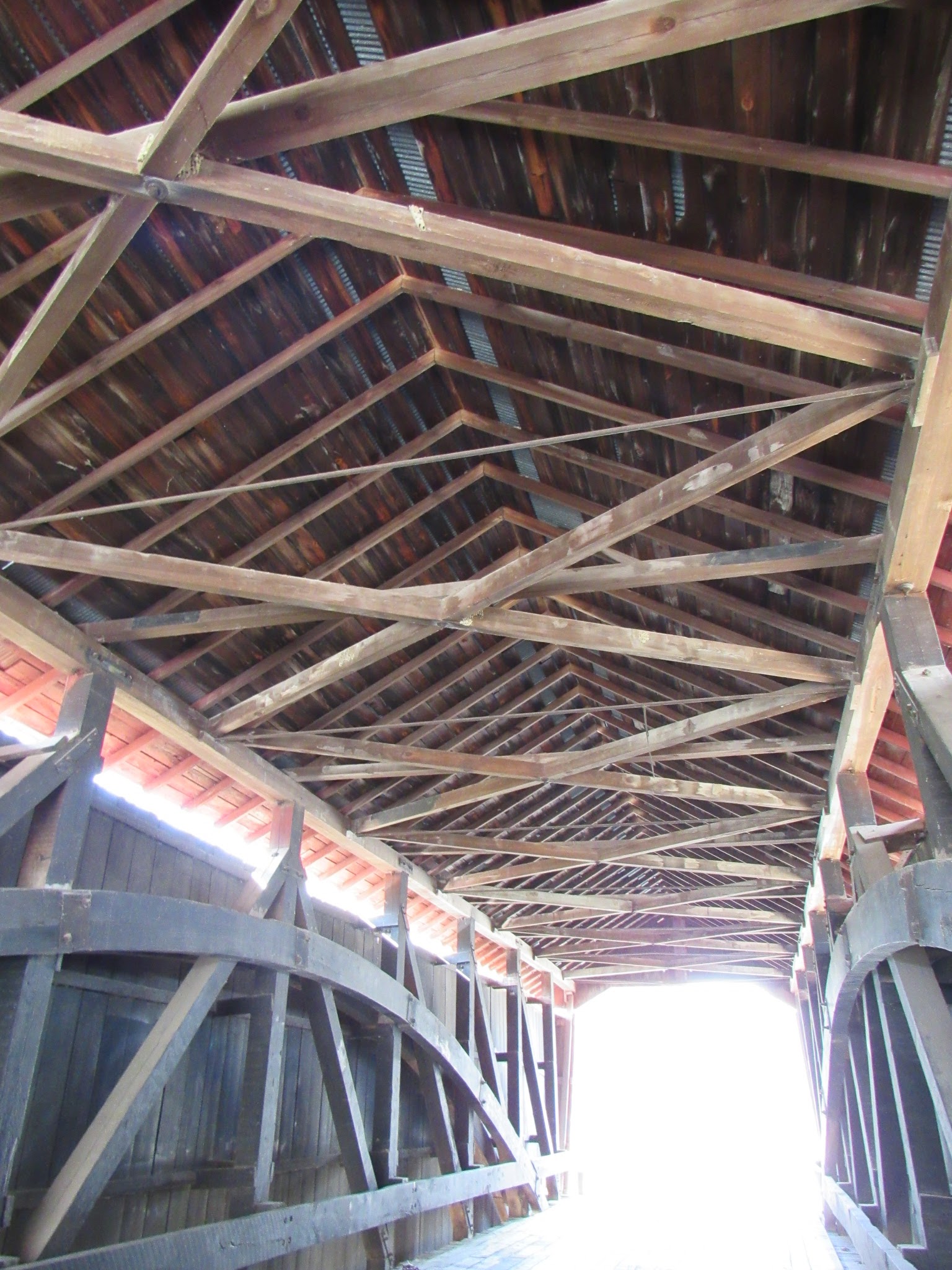
Our first stop was at the historic Scotland Hotel, built was built in 1879 for town merchant William Haig.  He used portions of an earlier building thought to date to the mid 1860s.  It has what is known as a hipped roof  (a style of roof built where all sides slope downward toward the walls, with no gables) and has a full front porch.  The style of the construction is called Italianate and was popular in the 19th century (particularly the 1840s-1890s in the US) and models the architectural style of the 16th century Italian Renaissance.

The house was listed in 1993 on the Historic Register of Places (the plaque shown in the image above).  According to the files register with the Department of the Interior, the house has four contributing buildings on the property, the hotel itself, a smokehouse, and two outhouses.  I noticed the smokehouse, which I completely forgot to take a photo of, but it is located just behind the main building, but I didn't see the outhouses.  It is said to have a foundation from locally hewn limestone is sided with wooden clapboard.

It went out of use as a hotel sometime in the 1960s and at some point became the Scotland Historical Society.  I hope to be able to go back at some point and take a look inside.  

According to the description of the interior, the main floor has five rooms including a gathering room, a parlor, dining room, kitchen and the "drummer's room", a room for salesmen to display their goods.  A drummer was a salesman that would travel to Bloomfield by rail then hire a driver at a livery stable to take them to Scotland.  They were stay at the hotel and display their wares in this drummer's room.  Local merchants would peruse the wares then purchase them to resell in their own shops.  

The second floor are all bedrooms and it has an unfinished attic. There is no plumbing in the building, but electricity was added in the 1930s, however there is no furnace or other heat source.  Originally, the heat was probably provided by stoves.  I didn't notice an chimneys on the outside of the house, so I assume that there are no fireplaces.  It seems odd since most all Victorian homes had some sort of fireplace or at least a flue for a wood stove.

This building was very important in the history of the small town as Scotland was considered the most significant commercial center of Taylor Township as well as parts of nearby Daviess and Martin Counties.  Many families used the hotel as a place to board their children while attending the local high school.  During the 1940s, this building also housed the Taylor Township trustee, Lewis Waggoner, in the sewing room and then during World War II the building housed workers for nearby Crane Naval Base, known then as the Crane Navel Ammunition Depot. 

~~~~
The first settlers in Taylor Township were Daniel Wallace, George Anderson, Robert Anderson, Abel Westfall, Thomas Barker and his son Obediah T. Barker, John Summerville, James, Nathaniel, William and Henry Cochran.  It is said that David Wallace and the two Anderson brothers, George and Robert, all natives of Scotland, were the first to enter land in this area.  The first marriage in the area was in September of 1821 between William Richey and Nelly Rumsers.  Not long after was the birth of the first child.

1879 Map of Scotland, Indiana

The town was founded in 1834/35 by Scottish settlers coming from Ohio, Pennsylvania, North and South Carolinas, Tennessee and Kentucky to find their fortune in the newly discovered coal veins.  Mining bolstered the economy of the town, as well as neighboring towns.   In fact, one newspaper stated that there was enough coal in the ground that would make every citizen as rich as a Vanderbilt.  The first store in town was opened by Obediah T. Barker, which led to him and his brother, Thomas, to plat the town in August of 1835.  The post office was established in 1837 with Obediah as postmaster.  The first grist mill was built in 1845 by Andrew Allen and in 1885 there were three hardware stores, three drug stores (John Morrison, William Woods are listed as two druggists), three general stores, a restaurant, a blacksmith, a livery, two doctors (one was Doctor R.S.J. Benefield for a while, another was Thomas Dagley), a building and loan association, a cotton carding mill, a pottery shop, a tannery (owned and operated by John Harrell), a broom maker's shop (run by James J. Langton), a tavern (run at one time by William Woods, the druggist) and a barrell-head maker's shop, in addition to the hotel.  The town was booming in this time period with the discovery of coal.    There is also mention of a wagon shop run by Stephen Isengole and a Temperance Hall which was used as a schoolhouse.  I do not know if this is the same schoolhouse that Obediah Barker taught in or not, but I don't think it was.  There were several small log buildings that were used as school houses and all had a variety of teachers.

Late in the 1830s, a Methodist group was formed and in the 1840s the first church was built from log.  But at some point the church and everything disappeared.  I am not sure that if it meant that the entire congregation disappeared or what.  A Christian Church came along just after the Methodist church disappeared.  Another Methodist Church came along, built in the early 1880s, followed close behind by a Baptist Church.  This church, however, burnt down.  We did notice a small, white framed Methodist Church in town as we were driving around.  I don't know what the relation of this current church is to the one built in the 1880s is.  We didn't notice any other churches in town.

In 1843, a contract was entered between the county and Obediah T. Barker that he would take the "permanent paupers of the county" into his home and take care of them.  For this action, he would be paid for his trouble as well as for all of the necessary expenses.  It was listed that the first ones in his care were Abner Hunter, Thomas Roach and Martha Roach.  In 1846, there must have been more paupers listed in the county, as it is noted that Mr. Barker "agreed to provide all necessaries for the county paupers, old and young, and keep them at his 'Asylum' in Scotland, for $1 each per week".  He didn't stay in the position of taking care of the poor for long after, as in 1847, Nancy Hatfield took over and just a few months later, the county board decided to create a poor farm.  I did notice not too far away was a sign called Minks Poor Farm, but I don't know if this is the same place or not. 

According to the Greene County Historical Society, the first school was built just before the Civil War and was used until 1870.  This sign, in particular, refers to the first high school which was built in 1912, though it is shown to have been integrated into the Bloomfield School District in 1955.  The grade schools were gone by 1942.

In 1861, at the start of the Civil War, war meetings were held in Scotland as well as in many other towns nearby.  They managed to gather up enough men, 82 in total, to march to Bloomington to meet up with the rest of the Twenty-First Regiment.  They made up Company C and marched together on to Indianapolis.  Later in 1861, another group was formed as part of the Fifty-Ninth Regiment and in 1862 they moved on to New Albany.

In 1875 it was stated that Scotland was "the voting precinct and main trading point in Taylor township" and "is quite a flourishing little village" containing "several good business, homes, schools, churches, etc.  The population is about three hundred inhabitants".  

Brick Star Studio,
Scotland, Indiana
Unfortunately, the prosperity only lasted until the around the 1920s when the coal resources had diminished.  Farming was not as productive due to the land being unsuitable for it.  So much of the town started to fade away and in fact, not much of the original commercial center remains, aside from a brick Italianate building, located just next door to the hotel. 

This building is now being used as a studio called the Brick Star Studio, which is like a community meeting spot as well as a photography studio.  They offer a variety of family activities and also coffee and snacks.  Unfortunately, their website no longer exists, however they have a face book page.

The town became rather stagnant during the Great Depression.  By this time, the coal had more or less run its course and farming was nearly non-existent.  But, at the end of the 1930s, the town started to look up again when Federal Agents purchased thousands of acres of land in nearby Martin County (only three miles away).  This was proposed to be a state park, locally known as the White River Land Utilization Project (the White River is only a few miles from Scotland).  It was dedicated in 1939, but in the later part of 1940, the US Navy seized land, as well more land next to it, and established Crane Naval Ammunition Depot.  With the construction of the navel base and the village of Crane that popped up with it, came thousands of workers and a boom for the town of Scotland.

The Scotland hotel became the Scotland Historical society in 1971 when it was formed to save the building.  It was listed in 1993 on the National Historic Register of Places.

~~~

Local histories state that there was a cave near Scotland that was called The Alum Cave due to the discovery of pure alum.  The cave was not a large one, but was large enough for bear.  The Hatfields of the town chase at least one there and killed it at some point early on.

Snake Hollow is called such due to the large number of snakes found there during the springtime.  

Apparently, bear were killed regularly in the area and one particular story involves Cornelius Bogard who was out deer hunting with his dogs when he found bear tracks in the snow.  His dogs caught the scent and chased the bear from the part of Daviess County where he was hunting into the area where Scotland is located.  The dogs chased the bear up a tree where Bogard was able to shoot and kill it.  He also was very successful in hunting deer.  On Spring Creek, Old man Doan killed a panther on his return from a hunt.  

~~~

For such a small town, there is a lot of history here.  This is just a bit of what I read about the town and the township in general.  Refer to the resources below for more information.

Resources:

National Register of Historic Places 
Scotland, Indiana Wikipedia Page
Scotland Hotel Wikipedia Page
History of Greene and Sullivan Counties, State of Indiana, From the Earliest Time to the Present, Together with Interesting Biographical Sketches, Reminiscences, Notes, Etc.
Greene County, Indiana Historical Society.

~~~

Thanks for joining us on our road trip to Scotland, Indiana.


Friday, January 4, 2019

Story, Indiana

Our first stop is an accidental trip to the quaint, little town of Story, Indiana located in Brown County.  We happened upon this town quite by accident when we were out searching for nearby cemeteries.  I had always heard about Story, but had never found myself anywhere near there.

GPS Coordinates: 39.098889, -86.213889

For such a small town, Story, Indiana has a vivid history.  The area where story is located was acquired from the Native American tribes that lived there in two parts based on a treaty known as the "Ten O'Clock Treaty Line".  This line ran from the southeast to the northwest and was also known as the "Indian Boundary Line".  The land to the southwest of the line was purchased in 1809 as part of the Treaty of Fort Wayne.  This purchase was called "Harrison's Purchase", named after William Henry Harrison who was the governor of the Indiana Territory at the time.   The area, including what would become Story, was opened to European Settlement on September 30, 1809.   The "Ten O'Clock Treaty Line" ran right through the village of Story and today there is a monument in the center of Story's village green. We did see the monument the day that we were there, but did not have an opportunity to get a picture of it.

The village is named for Doctor George P. Story who received land from Millard Fillmore in 1851.  Doctor Story was born around 1809 in Pennsylvania, settling in Ohio as a young man.  His first wife was Catherine Shelenburger.  They had one son, David.  Catherine died early and Doctor Story remarried to a woman named Jane Morrison.  Together they had two more sons, Enoch and George.  After he received the land from President Fillmore, he moved his family to Brown County.  The original land patent is on display in the Story Inn, pictured above. 

Over the next 20 years, Doctor Story's medical practice, a township school and a grist mill were all established.  Locals began to call the area Storyville.    Doctor Story served as the area of physician for around thirty years, but he was also the postmaster from 1860-1879 in Valley Hill.  It is thought that Story may have been called this beforehand.   Doctor Story's sons married women from Brown
County but they didn't stay long.  None of them seemed to have any interest in sticking around to help with the newly founded town.  Jane Story died in 1872 is buried in nearby Christiansburg Cemetery.  An unnamed infant is buried next to her, but that appears to have been the infant child, possibly a twin, of Jane's son, George and his wife.  You can visit my other blog, A Walk Through the Tombstones, to see the entry on the cemetery.

George married a third time to Sandusky Percifield.  His sons were gone, having moved to Kansas and Missouri.  With his family gone and advancing in age, he sold the land to John Noblet in 1882 and headed west.  That was the last he was heard of.

Even though the village was started in about 1851, it was officially established in 1882 when Doctor Arnold Griffitt took over the medical practice and began a farm.  He also started a dry goods store which had the post office located in it.  The first church was also founded.  The Story-Griffitt House (1858) is now part of the Story Inn.

Other towns around Story began to fade away in the early 1900s, which made this little town more important.  The general store was important to the town and the surrounding inhabitants and continued to hold a high place until about the 1950s.  During the 1880-90s, the village centered around the store and the grist mill, later owned by Willard Fulks.  A saw mill came later as well as a blacksmith and slaughterhouse.  In 1900, the store and grist mill were sold to Alra and Mary Wheeler.  The store was then called The Wheeler Store and they lived across from it in the Wheeler-Hedrick House (1894).


In 1915, the store burned down.  This didn't stop them from rebuilding and restocking the store.  The new store was a two-story building with the name Wheeler General Store emblazoned across the front.  In the 1920s, a second store was opened to feed off of the prosperity of the first, but it didn't last long and closed by the early 1930s.

Wheeler died in 1921.  The store, saw mill, Wheeler home and land around the buildings was purchased by Albert and Susan Hedrick.  They renamed the store "Hedrick & Son Grocery".  During the time that the Hedrick's owned the store, it was the most prosperous of all.  The store sold all manner of things, including but not limited to, farm equipment, clothing, shoes, local produce and meat, which was processed on-site at the slaughterhouse.

In the 1920s, the government began to offer payment for land in the area for the formation of Brown County State Park.  Due to the poor farming in the area, people gladly sold off their land.  It didn't help that the Great Depression (1929-1933) was coming.  Many saw that farming was no longer sufficient to keep alive, so they abandoned their farms and left in search of better work.  Between 1930 and 1940, Brown County lost half of its population and much of the farming ground to a halt.  Even more of the area in and around Story was lost with the formation of Yellowwood State Forest, the Hoosier National Forest and Charles C. Deam Wilderness.  These formations make Brown County a beautiful, wooded location, but also severely hurt the towns in the area.

In 1960, when the US Army Corps of Engineers flooded land to make Monroe Lake, the town of Elkinsville was abandoned and the road that once connected Story to Bloomington was closed.  Today, Elkinsville Road runs through the middle of town but dead ends about four miles up the road and an old iron bridge.

The store continued operation under the Hedrick name with their daughter running it.  She installed a lunch counter to serve park visitors and those passing through.  The store also operated the only fuel service in the area.

In the 1970s, the area of Story, Indiana was purchased by Benjamin and Cynthia Schultz.  Their dream was for a bed and breakfast and to make Story a destination spot.  With this, the Story Inn was born.  But, they sold the Inn in 1992 and it once again fell in disrepair.  The entire town was sold in 1999 at a sheriff's sale.  It was purchased and restored by a pair of investors.  Now the entire town has been revamped and is more prosperous than ever.  The bed and breakfast offers a lovely country setting for visitors with fine dining and accommodations.  Catering and weddings are offered in the surrounding lands and barn.

In March, Story hosts a Maple Syrup festival and in May, there is a National Wine Festival.


Sources:
Story, Indiana - Wikipedia
Countryfolk: Dr. George P. Story
Story Inn Website


All photos are mine.


Thursday, January 3, 2019

Welcome!

There is history all around us.  Everywhere you look, there is a story to be learned.  I have learned much over the three years that I have been chronicling cemeteries at A Walk Through The Tombstones and in learning of those families, I have found so much about the towns and locales where they lived.  I felt that it was time to talk about those as well.

So in conjunction with A Walk Through The Tombstones, I introduce you to Towns Gone By, a place where the lives of those buried near by will come to life in the towns where they lived.

But, granted, not all small towns had cemeteries.  So I am going to do my best to talk about those, too.  It is very important to me that none of these places are forgotten.  And, as time marches on, they are being overgrown by land or bulldozed to build a strip mall.  It's not fair to the memory of those that lived and thrived there. 

Check back often. I hope to be able to updated frequently. 

Please follow me at both of my blogs, A Walk Through The Tombstones and Towns Gone By.

Thanks!

Template by:

Free Blog Templates